
This page collects maps depicting areas, specific sites, and battles pertaining to the 42nd's time in North America. In most cases, clicking on the thumbnail image will lead to very high-resolution versions of each map.
Plans of Forts
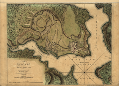
A Plan of the Town and Fort of Carillon at Ticonderoga
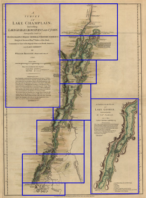
Survey of Lake Champlaign
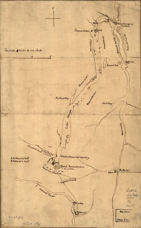
Plan of the attack on Fort William Henry and Ticonderoga;
showing the road from Fort Edward, Montcalm's
camp and wharf of landing, &c
Crown Point, 1759
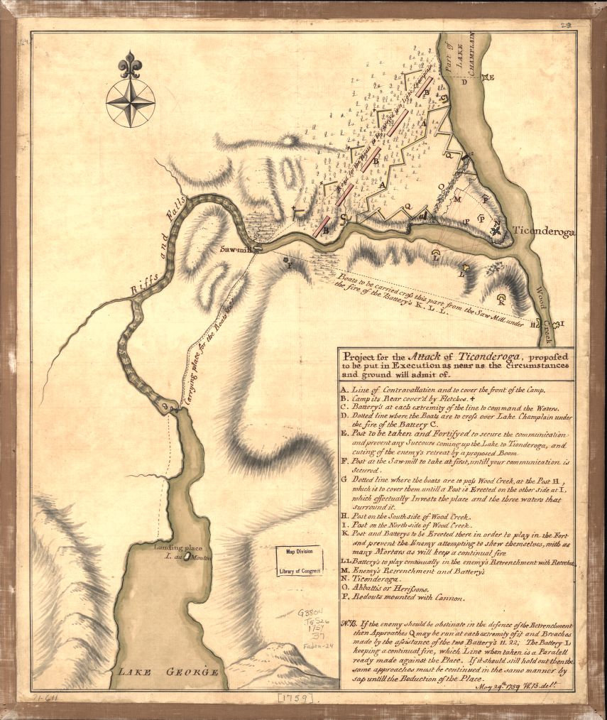
Plan of attack,
Ticonderoga, 1759
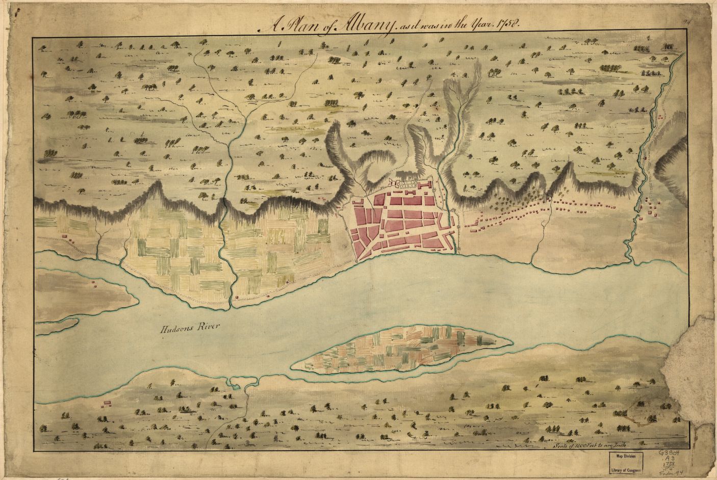
A Plan of Albany, as it was in the year 1758.
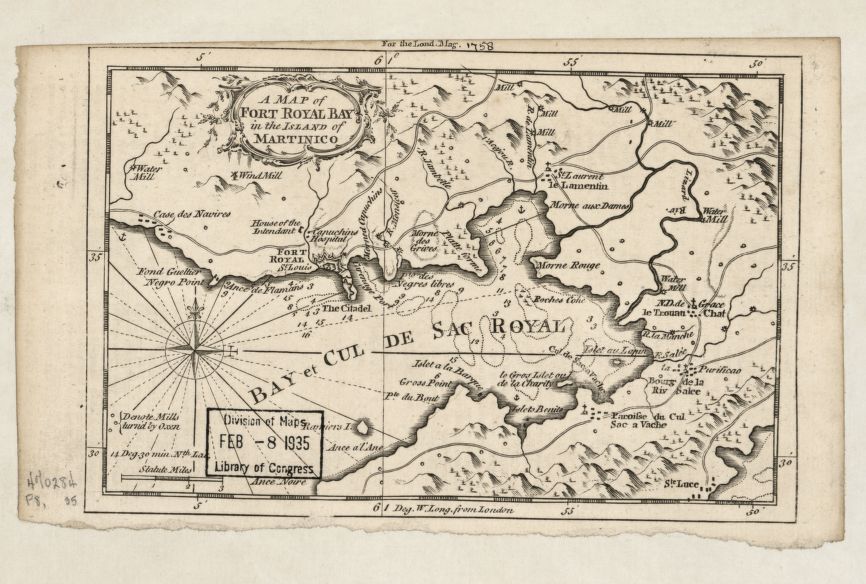
A map of Fort Royal Bay in
the island of Martinico.
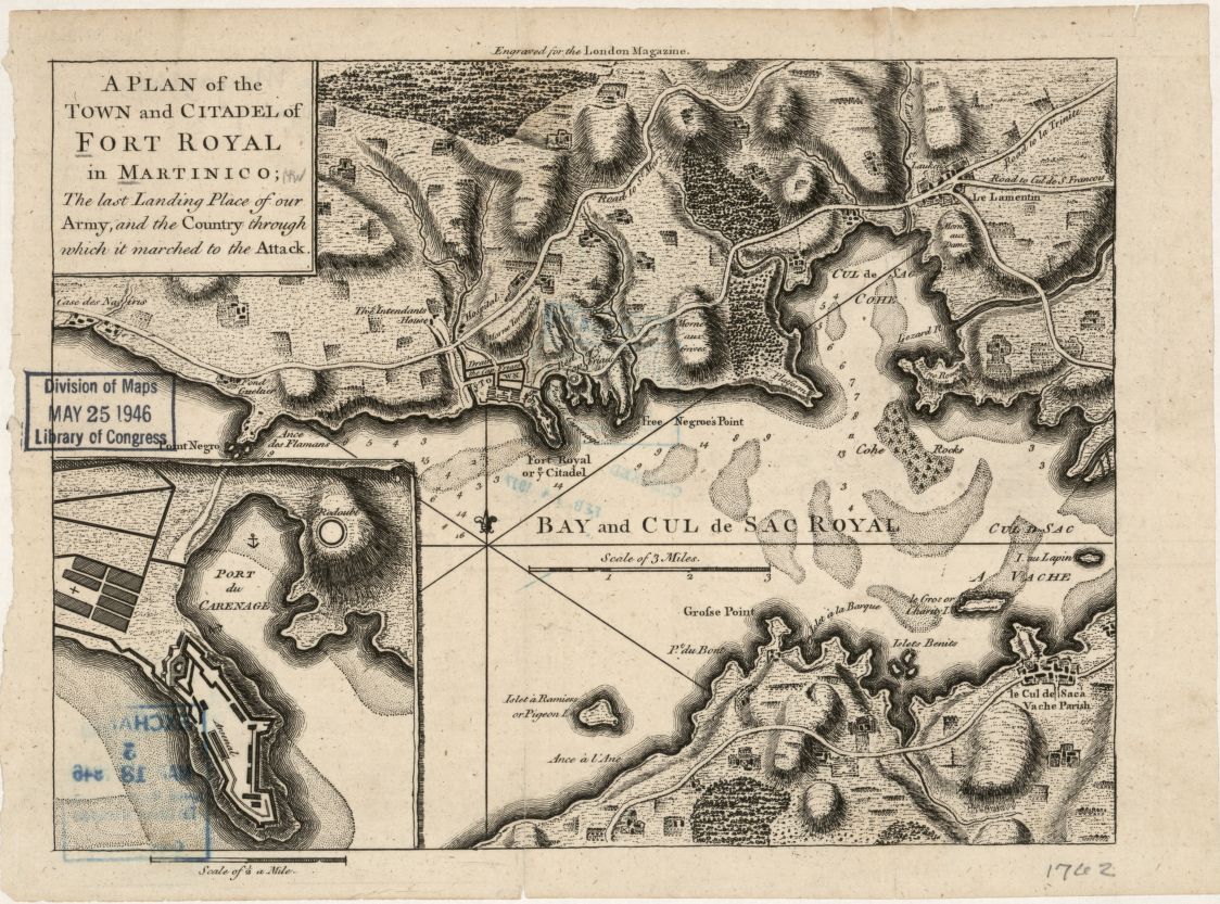
A plan of the town and citadel
of Fort Royal in Martinico
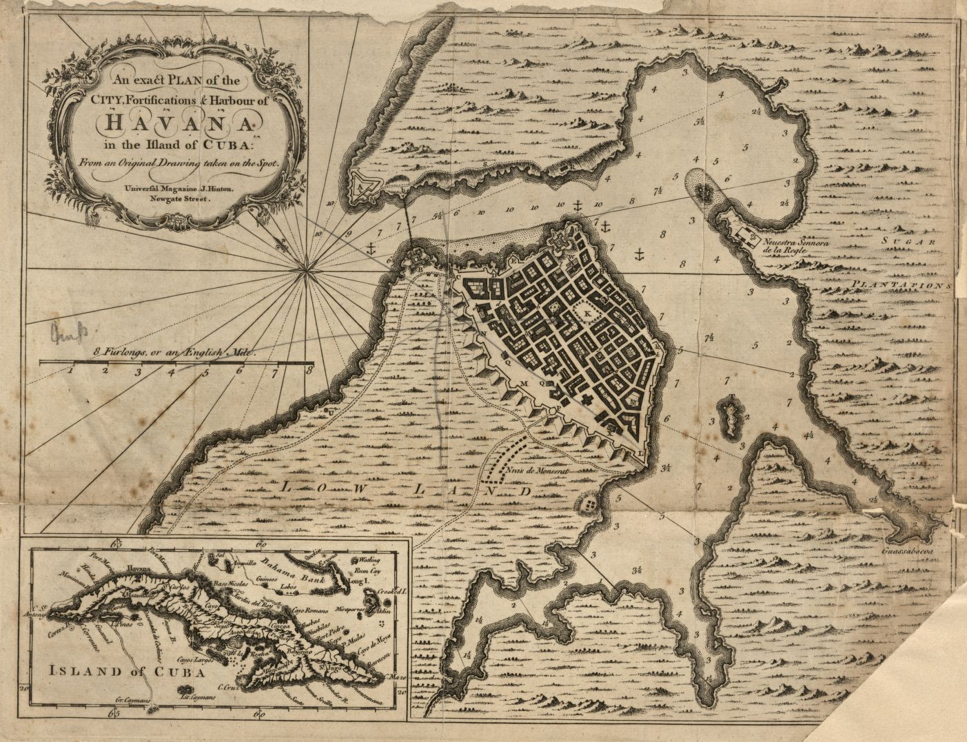
Havana, 1762

A Map of the Island of Guadaloupe
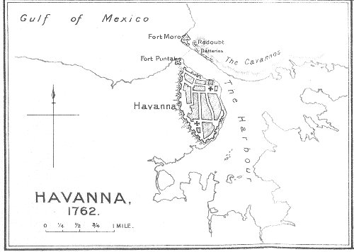
British Map of Havana
(John Fortescue's History
of the British Army Volume 2
Maps of Fort Pitt

Bouquet's Muskingum Expedition,1764
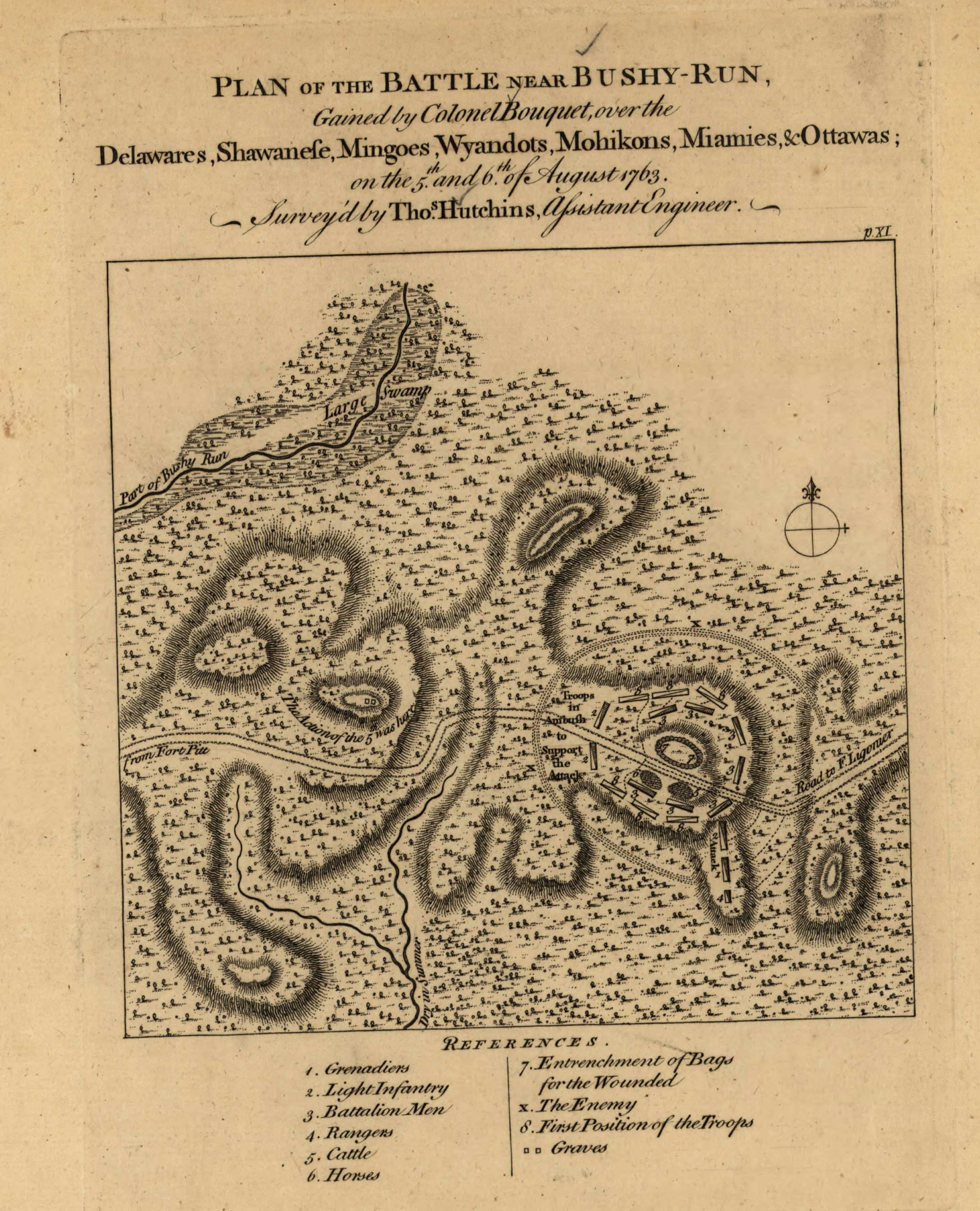
Bushy Run Battle

Fort Du Quesne, now Pittsburgh and its environs

Rough Plan of Fort Ligonier

Plan of Fort Ligonier
with part of the retrenchment

Plan of the Retrench'd Camp, at Fort Ligonier
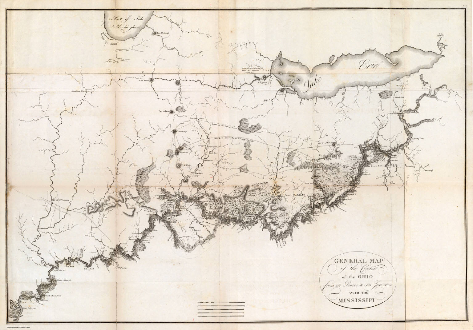
General Map of the Course of the Ohio
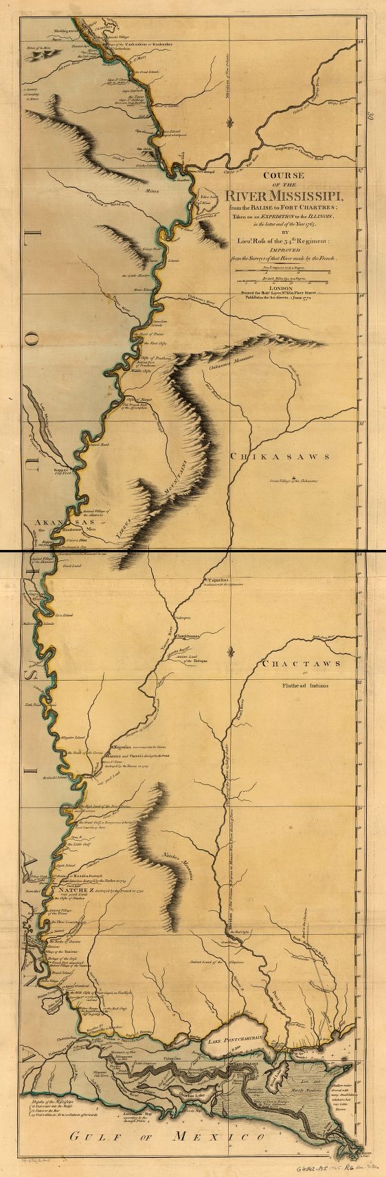
Course of the river Mississippi,
from the Balise to Fort Chartres
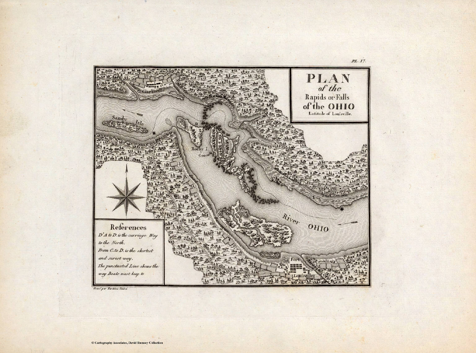
Plan of the Rapids or Falls of the Ohio
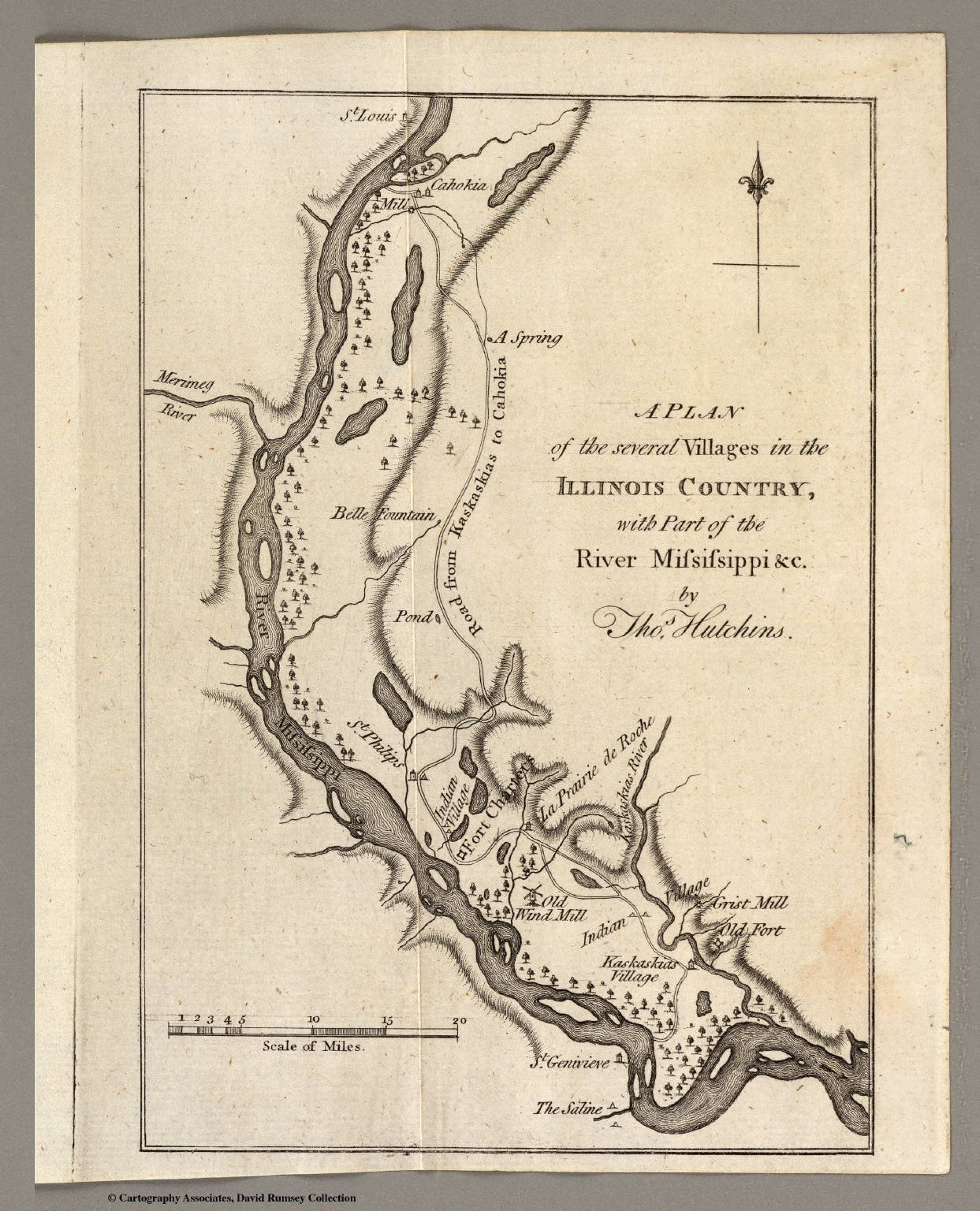
A Plan of the several Villages
in the Illinois Country
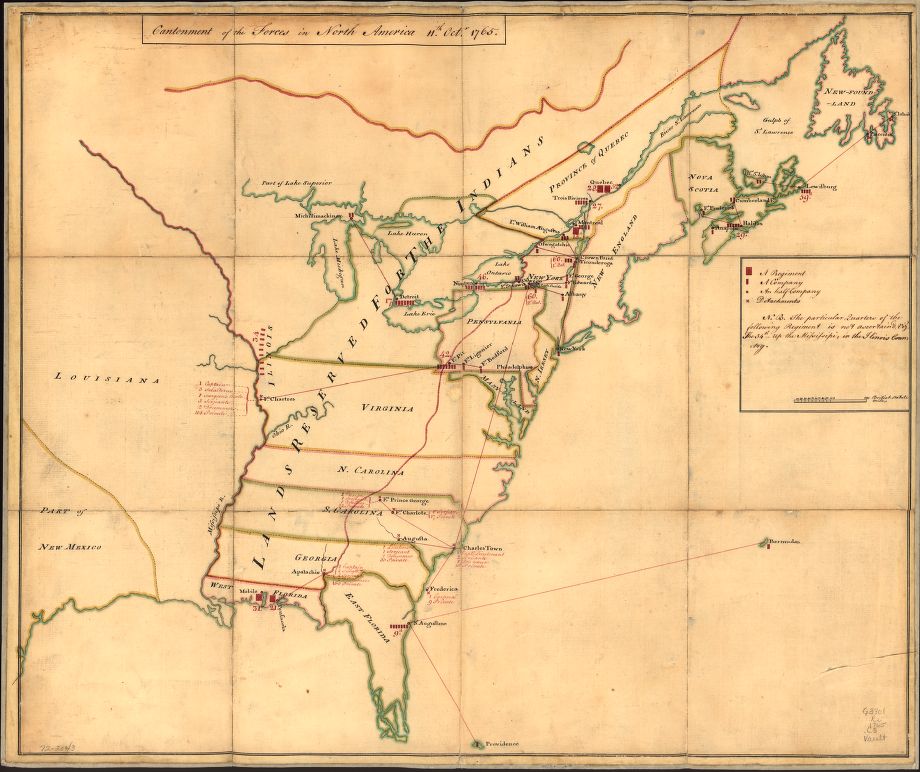
Cantonment of the forces in North
America 11th. Octr. 1765.
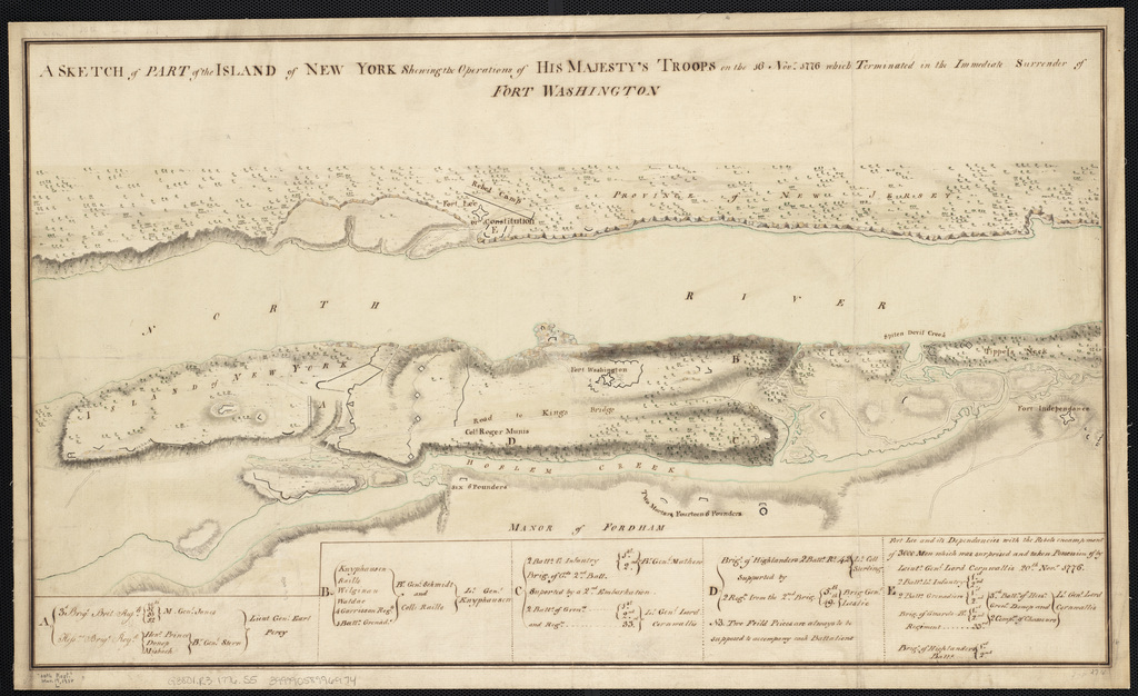
Map of Ft Washington
Boston Public Library)
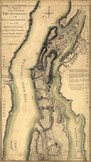
A plan of the attack of Fort Washington,
now Fort Knyphausen, and of the American lines on
New-York Island by the King's troops,
on the 16th of November 1776.
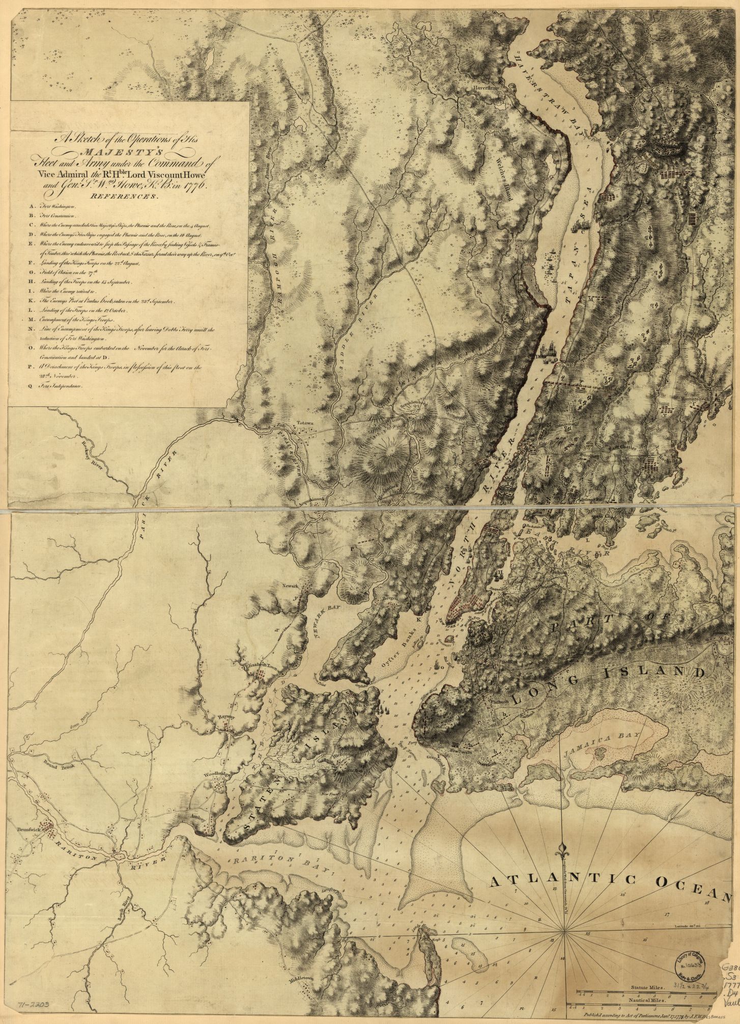
A sketch of the operations of
His Majesty's fleet and army under
the command of Vice Admiral the Rt. Hble.
Lord Viscount Howe and Genl.
Sr. Wm. Howe, K.B., in 1776.
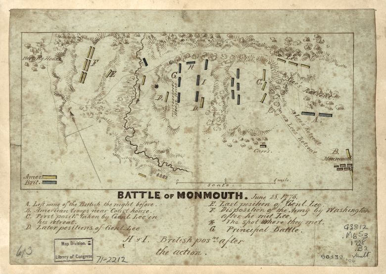
Monmouth
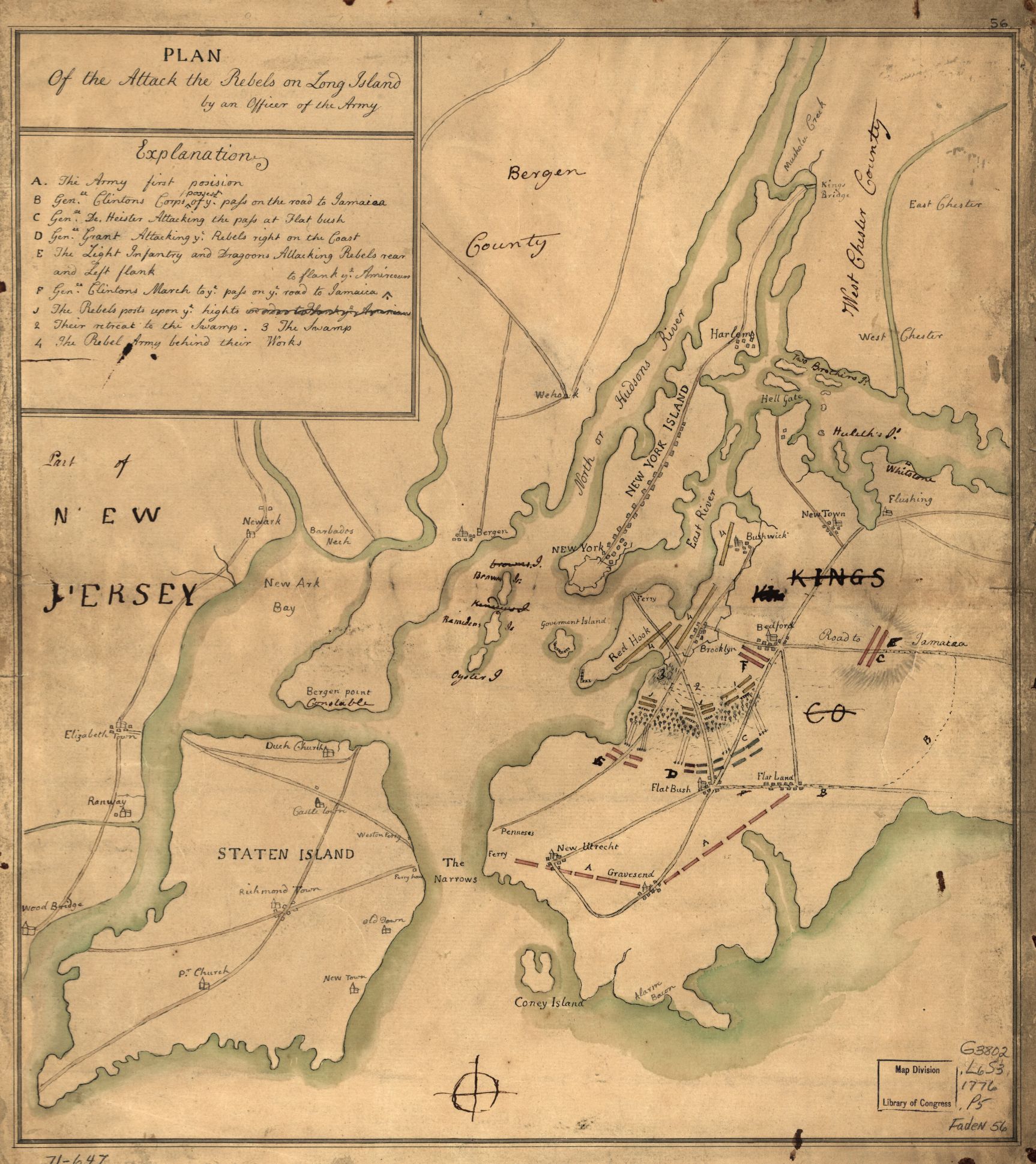
Battle of Long Island
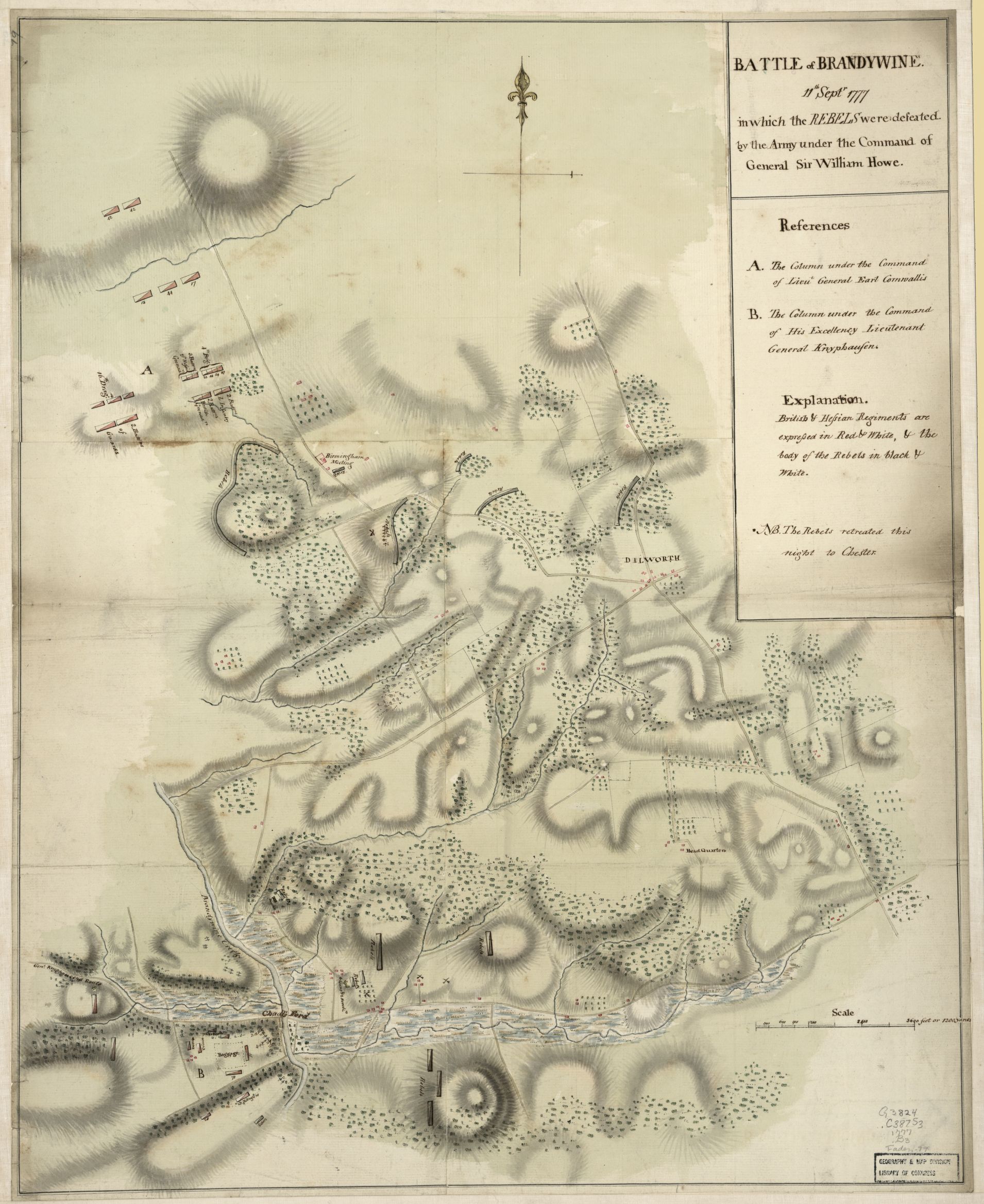
Battle of Brandywine, 11th Septr. 1777,
in which the rebels were defeated by the army under
the command of General Sir William Howe.
Stony Point, 1779
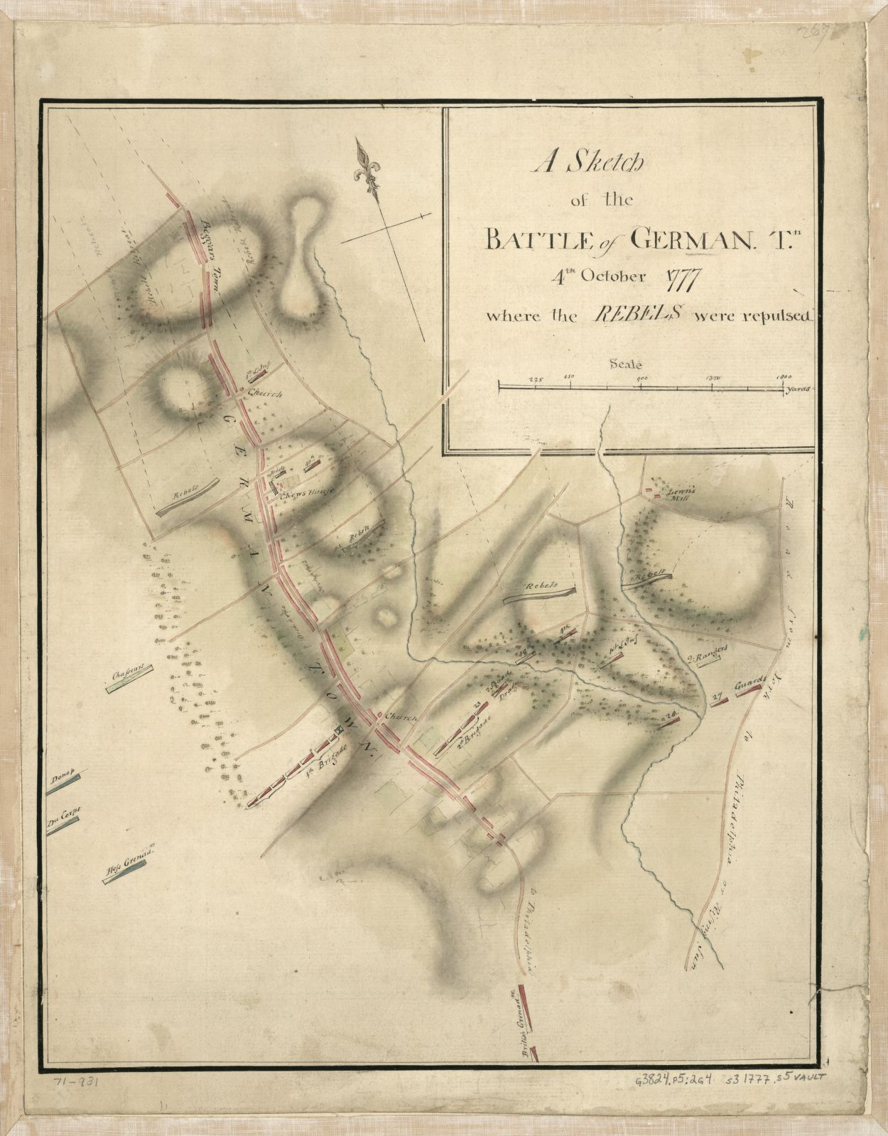
Sketch of Germantown, 1777

Germantown
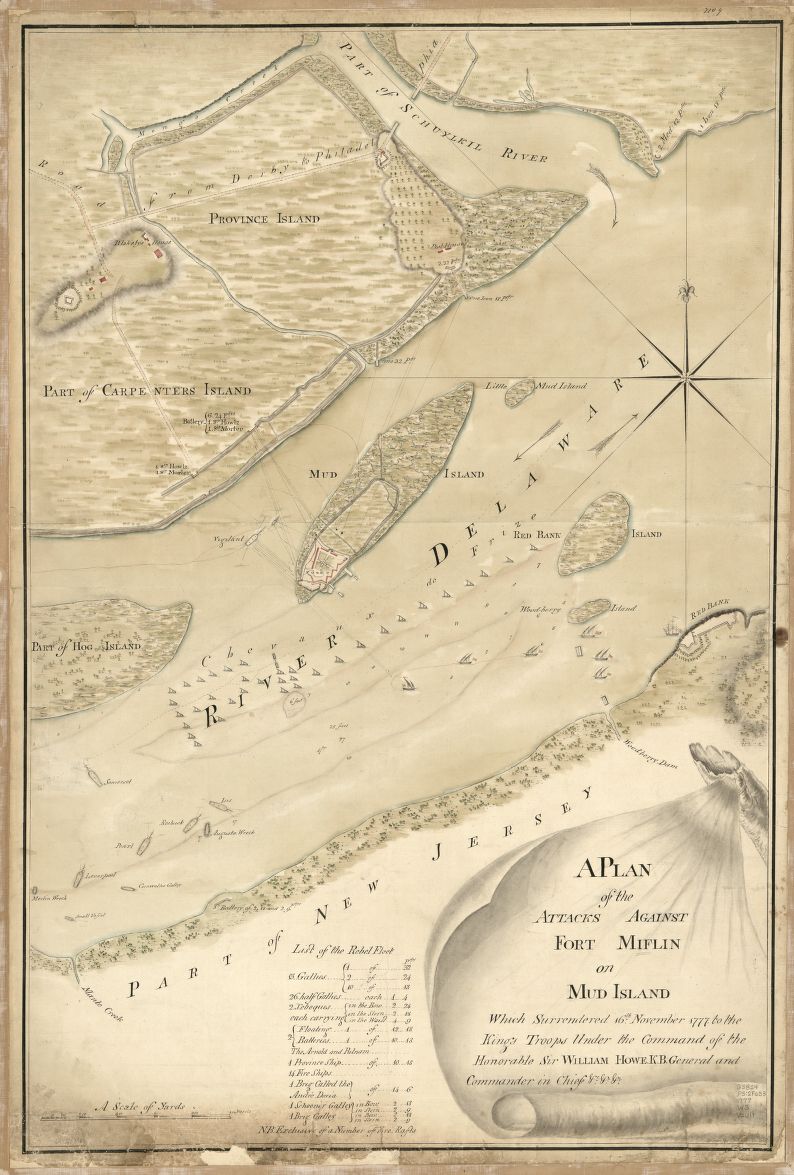
A plan of the attacks against Fort Miflin
on Mud Island which surrendered 16th,
November 1777 to the Kings troops
under the command of the honorable Sir
William Howe K.B. general and
commander in chief &c., &c.
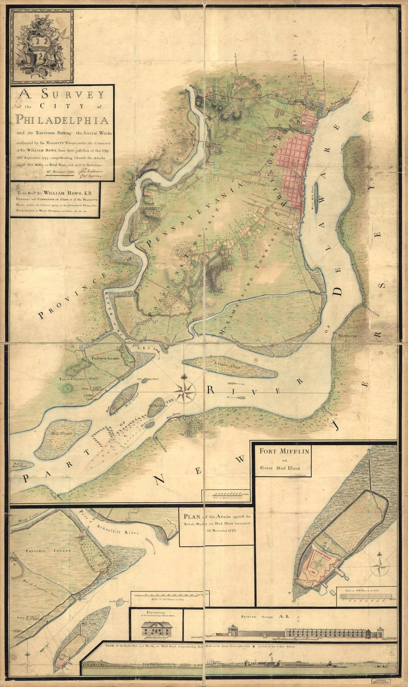
Map of Philadelphia,
including Mud Island

British Map of Charleston
Overview of the 42nd's North American service
View The 42nd Highlanders in North America in a larger map
psmith@42ndRHR.org
http://www.42ndRHR.org
Last modified: April 12, 2021
Copyright © 2013
Preston M. Smith and the 42nd Royal Highlanders, Inc.
All rights reserved.
Blog |
Main Page |
Pipes |
Fifes |
Drums |
Dancing |
Escort to the Colors |
Pictures |
Booking the 42nd |
History |
Maps |
DeChartres |
Ireland |
Uniforms |
Warrants & Inspections |
Rev. War Officer Lists |
Links |
Bibliography |
42nd Recordings |
42nd Merchandise |
Griffin Endowment |
Scottish Society |
Burns Supper |
Forfar Bridie Booth |
The Whole 9 Yards |
Golf Outing |
2013 Tour of Scotland
|